












📈 Register today: Spatial Analysis Webinar this Tuesday, December 15th!
Good morning! The Spatial Analysis Workgroup is happy to annouce an upcoming webinar for the month of December!
Please join us on Tuesday, December 15th at 1:00pm EST to learn more about Esri ArcGIS Insights from Mr. Warren Roberts.
DESCRIPTION:
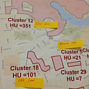
Esri ArcGIS Insights is a powerful analysis made intuitively powerful through the browser. Unlock new insights for all skill levels, across departments by enriching your data by service planning areas, health districts, zip codes or any other boundaries or point data to answer questions you didn’t know to ask by visualizing, analyzing and sharing data from multiple sources on interactive maps, charts, and tables.
Please join us on Tuesday, December 15th at 1:00pm EST to learn more about Esri ArcGIS Insights from Mr. Warren Roberts.
DESCRIPTION:
Esri ArcGIS Insights is a powerful analysis made intuitively powerful through the browser. Unlock new insights for all skill levels, across departments by enriching your data by service planning areas, health districts, zip codes or any other boundaries or point data to answer questions you didn’t know to ask by visualizing, analyzing and sharing data from multiple sources on interactive maps, charts, and tables.
ABOUT OUR SPEAKER:
Warren Roberts is the GIS Coordinator and faculty at Rio Hondo College in Los Angeles County. The certificate curriculum is articulated with industry trends in GIS. His background is landscape architecture and addition to teaching at Rio Hondo College, he supports research, faculty and students throughout the Claremont colleges. For more information visit www.riohondo.edu/gis
Warren Roberts is the GIS Coordinator and faculty at Rio Hondo College in Los Angeles County. The certificate curriculum is articulated with industry trends in GIS. His background is landscape architecture and addition to teaching at Rio Hondo College, he supports research, faculty and students throughout the Claremont colleges. For more information visit www.riohondo.edu/gis
Registration is required for attendance. To register for this session: https://cste.webex.com/cste/k2/j.php?MTID=t7db7018c8bd6942c0a287bf20f9038e3
Once the host approves your registration, you will receive a confirmation email with instructions for joining the session.
If you have any questions, please email me at mpatselikos@cste.org.
Once the host approves your registration, you will receive a confirmation email with instructions for joining the session.
If you have any questions, please email me at mpatselikos@cste.org.