









Speaker Information 2 of 3: Reminder Webinar Tomorrow!
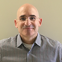
Bio: Christopher Ahmed is a spatial epidemiologist at the Washington State Department of Health. He works on the Washington Tracking Network (WTN), a program focused on making public health data more accessible through gathering and curating data and making it freely available online to download and interact with data (www.doh.wa.gov/DataandStatisticalReports/WashingtonTrackingNetworkWTN). WTN is funded through the Centers for Disease Control and Prevention (CDC) National Environmental Public Health Tracking Program.
Brief description of presentation:
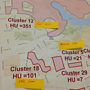
A visually balanced cartogram distorts geographic boundaries enlarging the smallest geographies to a size that a viewer can see. I used this method to create a visually balanced Washington State census tract map and evaluated how well this method addressed the urban census tract invisibility problem – a problem where population dense census tracts in urban areas become invisible to a viewer when a map is presented at a large spatial scale such as a state map. Before applying this method 59.8% of Washington census tracts were below the minimum size for visibility. After applying this method only 1.1% of census tracts remained invisible.
A visually balanced cartogram distorts geographic boundaries enlarging the smallest geographies to a size that a viewer can see. I used this method to create a visually balanced Washington State census tract map and evaluated how well this method addressed the urban census tract invisibility problem – a problem where population dense census tracts in urban areas become invisible to a viewer when a map is presented at a large spatial scale such as a state map. Before applying this method 59.8% of Washington census tracts were below the minimum size for visibility. After applying this method only 1.1% of census tracts remained invisible.
We are so exicted to hear Christopher's presentation tomorrow, November 17th at 1pm EST. If you have not registered for the Spatial Analysis Lightning Session yet, you may do so here: https://cste.webex.com/cste/k2/j.php?MTID=tff5f18e9989f568f2dee9a45510c8025
If you have any questions, please email me at mpatselikos@cste.org or comment below!